Multi-LiDAR Annotation: Handling Complex Sensor Setups
Modern autonomous trucks and robotics platforms run with three, five, sometimes eight LiDARs working at once. Each one sees the world differently. Annotating that picture at scale is where most teams hit a wall.
Multi-LiDAR annotation is the process of labeling 3D point cloud data captured from two or more LiDAR sensors operating on the same vehicle, where annotations must remain consistent across sensors, time, and overlapping fields of view.
Key Takeaways
- Multi-LiDAR setups generate 3 to 10 times more raw point cloud data per second than single-sensor configurations, and the annotation cost scales with how the data is handled, not just how much there is.
- Cross-sensor consistency, not labeling speed, is the metric that separates a useful multi-LiDAR dataset from a noisy one.
- Calibration-aware pipelines reduce duplicate and ghost annotations by 30 to 50 percent compared to per-sensor workflows.
- Sensor count is not what makes multi-LiDAR hard. Overlapping fields of view are. Two LiDARs that never see the same object add data volume but almost no annotation complexity.
- Teams running fleet-scale autonomous trucking or robotics typically need annotation platforms purpose-built for fused 3D point clouds, not generic 2D-first tools retrofitted with a 3D mode.
Why Multi-LiDAR Setups Break Single-Sensor Workflows
A single-LiDAR pipeline is a clean problem. One stream of points, one coordinate frame, one consistent density profile. Annotators see what the sensor sees, label what's there, and move on.
Add a second LiDAR. Now the same pedestrian appears in two point clouds with different densities, slightly different timestamps, and partial occlusion patterns that don't match. Add a third. Add a fourth covering the rear quadrant of a 53-foot trailer.
The annotation problem stops being about labeling and starts being about reconciliation. Which return belongs to which object? Is that cluster of points behind the truck a real obstacle or a reflection from the trailer chassis? Did the same vehicle get labeled three times because three sensors caught it from three angles?
This is why teams running 3+ LiDAR setups, common in autonomous trucking, mining robotics, and L4 passenger vehicles, find that the tools that worked at smaller sensor counts fall over once they scale. The labeling is the easy part. The consistency is the hard part.
What Actually Makes Multi-LiDAR Hard? Overlapping Sweeps
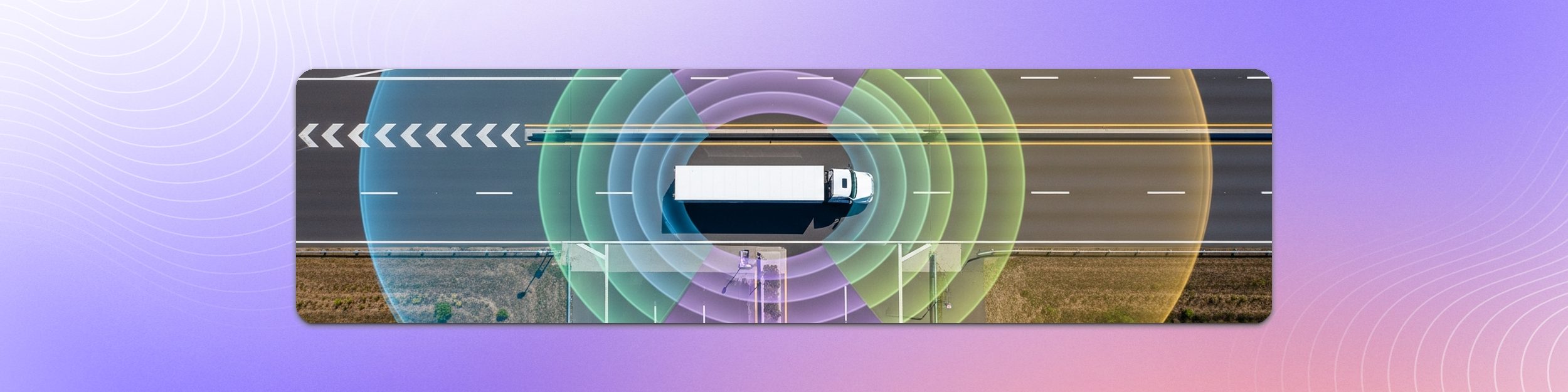
It is tempting to treat sensor count as the difficulty. It is not. Put one LiDAR at the front of a truck and one at the rear with no shared field of view, and you have two independent labeling problems that happen to ship in the same file. More data, same workflow.
The difficulty starts where the sweeps overlap. In the overlap region the same object produces returns in two or more point clouds, at slightly different timestamps, with different densities and different occlusion patterns. That is where the real failure modes live:
- Duplicate objects. The same vehicle labeled once per sensor, arriving downstream as two or three separate instances.
- Instance conflicts. Two sensors agree there is an object but disagree on its extent, heading, or class.
- Ghost returns. Reflections and self-returns from the ego vehicle, especially off a trailer chassis, that only one sensor sees.
- Seam artifacts. Objects that straddle the boundary between two sensors and get clipped in both.
So the first question to ask about any multi-LiDAR rig is not how many sensors it has. It is how much of the field of view is covered by more than one of them, and whether the annotation pipeline resolves that overlap once or leaves it to the annotator every time.
What Does "Calibration-Aware" Mean for Annotation?
Multi-LiDAR data is only as good as its calibration, and it is worth being precise about which parameters do what. Extrinsics (the position and orientation of each sensor relative to a common vehicle frame) are what let you treat eight separate point clouds as one fused observation of the world. That is the LiDAR-to-LiDAR problem.
Intrinsics are a camera property: focal length, principal point, lens distortion. They do not apply to a LiDAR. They matter the moment you bring cameras into the same workspace, because they are what makes a 3D box land in the right place in each individual image.
A calibration-aware annotation pipeline uses those parameters at every step. When an annotator draws a 3D box around a vehicle in the front-LiDAR frame, the box propagates to the side and rear LiDAR frames automatically, in the right pose, at the right time. The annotator validates rather than redraws.
Projecting into cameras is the part teams tend to underestimate. Each camera has its own intrinsics, its own mounting pose, and its own capture timestamp, and a truck moving at highway speed has travelled a measurable distance between the LiDAR sweep and the shutter. A pipeline that accounts for per-camera geometry and ego motion puts the box where the object actually is in that image. One that does not produces 3D labels that look correct in the point cloud and sit visibly off-object in every camera frame a model trains on.
Calibration-naive pipelines treat each sensor as an island. Annotators label the same object in each sensor's frame, often with slight inconsistencies that have to be cleaned up later. The cost shows up twice: in annotation hours and in downstream model performance.
This is one of the structural differences between annotation platforms purpose-built for multi-sensor autonomous driving and tools that started as 2D image annotation and added a 3D mode. The former assumes calibration is a first-class input. The latter treats it as an afterthought.
How Do You Keep Annotations Consistent Across Sensors?
Three things have to be true for a multi-LiDAR dataset to be useful for training a perception model:
- An object labeled in one sensor's view is labeled identically in every other sensor's view that sees it. Same class, same instance ID, same dimensions.
- Temporal consistency is preserved. A vehicle tracked across a 5-second sequence keeps the same instance ID across all LiDAR frames at every timestamp.
- Overlap is resolved once, not per sensor. Where two LiDARs see the same object, it is annotated a single time, in whichever view gives the clearest geometry for placing the box, and that box is then projected out to every sensor that sees it. The annotator is never asked to judge which sensor to believe, and every exported box for that object traces back to the same source of truth.
None of the three is an annotator-skill problem. Each one is a pipeline property: guidelines that encode the rules explicitly, tooling that resolves overlap at ingestion rather than at labeling time, and a quality assurance loop that surfaces cross-sensor inconsistencies before delivery rather than after.
Teams that try to handle this with general-purpose 3D bounding box tools end up rebuilding most of this infrastructure themselves. We've covered some of the edge cases that compound this problem in autonomous driving datasets (rare classes, partial occlusion, sensor failure) which all get worse at higher sensor counts.
How Do Robotics and Trucking Teams Choose an Annotation Platform for Multi-LiDAR Data?
Three questions tend to settle it.
Was the platform built for 3D point clouds, or was it retrofitted? A platform that started life as a 2D image annotation tool and added LiDAR support typically treats point clouds as a secondary citizen. You can see this in how it handles calibration, sensor fusion, and temporal sequences. Multi-LiDAR setups punish that lineage.
Does it handle multi-sensor consistency natively, or do you have to build it yourself? Some platforms expect you to label each sensor independently and reconcile later. Others fuse the sensors at ingestion and treat the multi-LiDAR observation as one labeling task. The second approach is the only one that scales past two or three sensors.
Can the operating model flex? Some teams want to run annotation in-house on a licensed platform. Some want finished, quality-assured data delivered. Most end up somewhere in between, running their own annotators on core classes and handing overflow or edge cases to the vendor. The question is whether one platform supports all three without a re-platform when the mix changes.
For teams running multi-LiDAR setups in trucking or robotics, Kognic's annotation platform was built around fused multi-sensor data from day one, with calibration-aware sensor fusion available as a self-service platform license, as a managed service, or as a hybrid of the two on the same pipeline.
Multi-LiDAR Annotation Platform Capabilities: What to Look For
| Capability | Single-LiDAR sufficient | Multi-LiDAR (3+) required |
|---|---|---|
| Native 3D point cloud annotation | Yes | Yes |
| Sensor fusion at ingestion | No | Yes |
| Calibration-aware annotation propagation | Optional | Critical |
| Cross-sensor consistency QA | Optional | Critical |
| Overlap-aware deduplication | No | Critical |
| Motion compensation handling | Sometimes | Always |
| Flexible operating model (self-serve, managed, hybrid) | Optional | Depends on in-house capacity |
| Temporal sequence support | Sometimes | Critical |
| Multi-sensor instance tracking | No | Critical |
If a platform scores "yes" on the left column but "no" on the right, it's a single-sensor tool. That's fine for early prototypes. It will not scale to a production fleet.
What This Means for Production Datasets
The teams that get multi-LiDAR annotation right share three habits.
They invest in annotation guidelines as much as in tooling. Edge cases, sensor disagreements, and ambiguous returns get explicit rules, not annotator judgment.
They measure consistency, not just throughput. Time-per-frame is a useful metric. A more useful one is the inter-sensor disagreement rate: how often the same object, in a region covered by two or more sensors, ends up with a different box, class, or instance ID depending on which sensor you look at. Tracked per batch, that single number tells you whether the pipeline is genuinely fusing the sensors or just labeling them in parallel and stapling the results together.
They treat calibration as part of the data contract, not an external concern. When calibration drifts, annotation quality drifts with it. Detecting calibration regressions in the annotation pipeline catches problems weeks before they show up in model performance.
The teams that get it wrong tend to underinvest in all three and try to compensate with annotator volume. The math doesn't work past a few hundred thousand frames.
Frequently Asked Questions
What is the best LiDAR annotation platform?
The best LiDAR annotation platform depends on sensor overlap and operational scale. For single-LiDAR prototypes, general-purpose 3D annotation tools are sufficient. For multi-LiDAR production fleets in autonomous trucking, robotics, or L4 passenger vehicles, the practical choice narrows to platforms purpose-built for fused multi-sensor data, with calibration-aware pipelines that resolve overlapping fields of view at ingestion rather than leaving it to the annotator.
Do two LiDARs always create a multi-LiDAR annotation problem?
No. If the two sensors have no shared field of view, for example one facing forward and one facing rearward on a rigid truck, the same object is never seen twice and there is nothing to reconcile. You get more data, not a harder labeling problem. The annotation complexity starts in the overlap region, where one object produces returns in several point clouds and the pipeline has to decide whether those returns are one instance or several.
How do robotics teams choose an annotation platform for LiDAR data?
Robotics teams typically evaluate three criteria: whether the platform was built for 3D point clouds from the start (rather than retrofitted from 2D), whether it resolves overlapping sensor coverage natively, and whether the operating model can flex between self-service, managed delivery, and a hybrid of the two as in-house capacity changes.
How many LiDAR sensors does a typical autonomous truck use?
Autonomous trucking platforms typically run between three and eight LiDAR sensors, covering long-range forward perception, side and rear blind spots, and trailer monitoring. The exact count depends on the operational design domain, but anything below three creates blind spots that are hard to close with camera or radar alone.
What is sensor fusion annotation?
Sensor fusion annotation is the practice of labeling objects and events on data that has been combined from multiple sensors (typically LiDAR, camera, and radar) into a unified observation. Done well, it produces ground truth that reflects what the vehicle's perception system actually sees, rather than what any single sensor captured in isolation.
How is multi-LiDAR annotation priced compared to single-sensor?
Multi-LiDAR annotation pricing scales with how the platform handles the extra sensors. Calibration-naive pipelines tend to multiply the cost roughly with the sensor count, since each sensor is labeled independently. Calibration-aware pipelines that propagate annotations across sensors typically add 30 to 60 percent over single-LiDAR cost, not 200 to 700 percent, because the labeling work is shared across the fused observation.
What This Means in Practice
Multi-LiDAR is no longer the exception. For autonomous trucking, robotics, and L4 passenger vehicles, it's the default. The annotation infrastructure that worked at one or two sensors does not survive the jump to four, six, or eight.
Teams that recognize this early invest in calibration-aware pipelines, explicit rules for the overlap regions, and an operating model that can flex as their own annotation capacity changes. Teams that don't tend to spend the next 18 months rebuilding what they could have started with.
Talk to us about how Kognic handles multi-LiDAR setups for autonomous trucking, robotics, and ADAS programs. Book a demo to see the platform in action with your own data.
Share this
Written by